Nearly 800 confirmed dead and more than 3,000 missing after a Himalayan glacier collapse sent a wall of ice, rock and mud through the Nepal-China border on August 26. Officials say existing warning systems were never built for a disaster that unfolded in minutes.
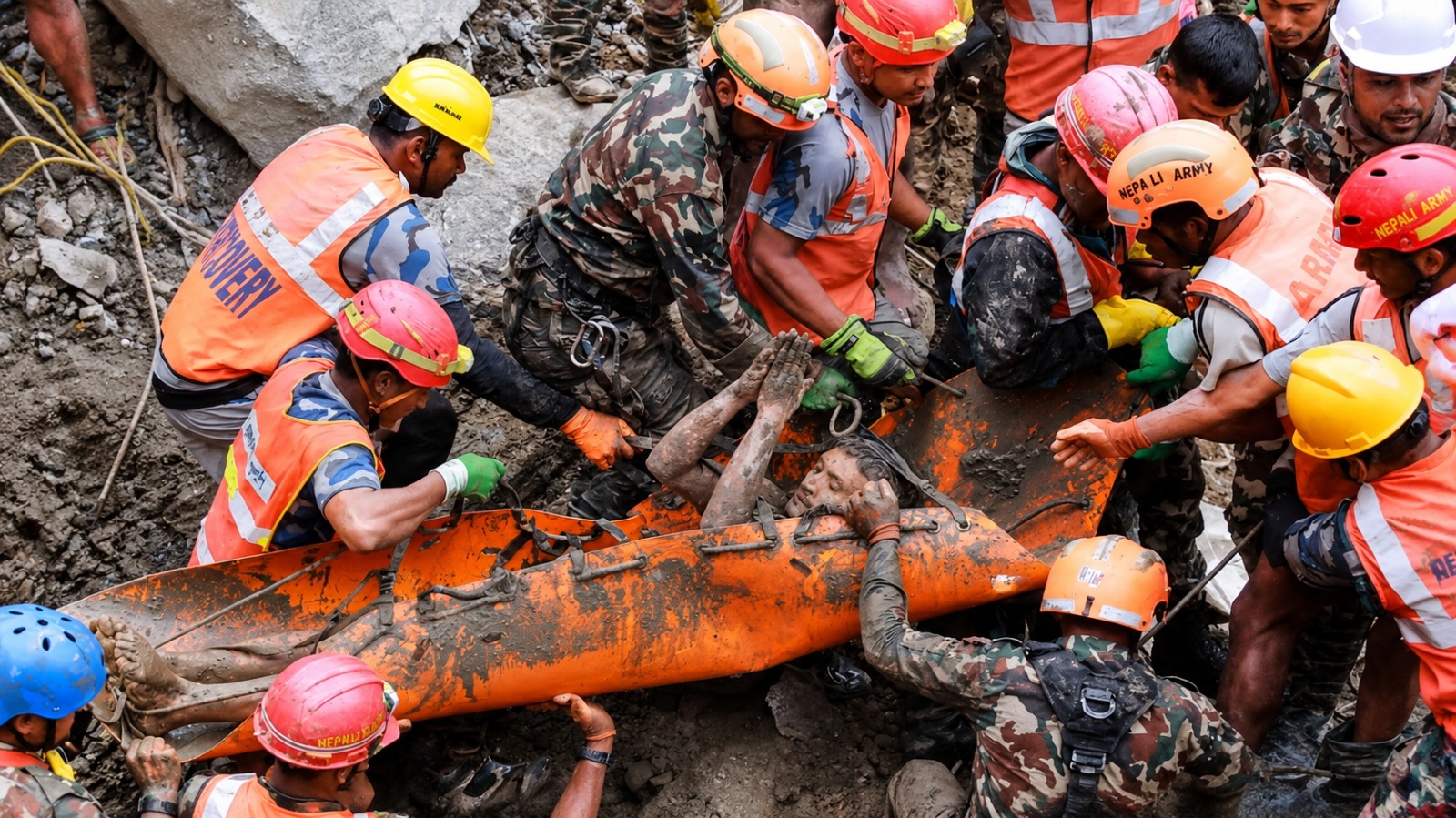
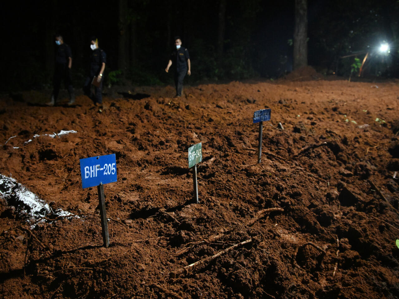
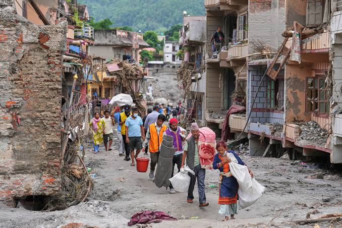
As of Sunday, August 30, Nepal’s National Disaster Risk Reduction and Management Authority (NDRRMA) put the country’s confirmed death toll at 781 to 788, with 2,502 people still unaccounted for. Chinese authorities reported 16 deaths and 546 missing in Tibet’s Gyirong County. Combined, the disaster has claimed about 800 lives, with more than 3,000 people missing. Figures remain provisional as bodies continue to be recovered far downstream, including in India. More than 9,400 people have been rescued or evacuated in Nepal. The Red Cross estimated more than 90,000 people were affected.
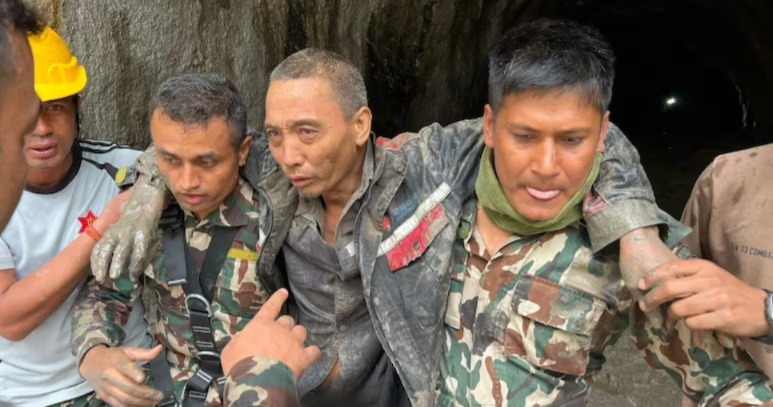
The missing include hundreds of foreign nationals from more than 30 countries - among them Indian pilgrims, trekkers from the United States, Australia, the United Kingdom and Canada and 933 workers tied to hydropower projects along the Bhotekoshi and Trishuli rivers. More than 100 people were feared trapped in tunnels at hydropower sites. Rescue work has been slowed by rain, damaged roads and the risk of further flooding.
How the flood happened
The disaster began on the morning of Wednesday, August 26, high in the Himalayas near Langtang Lirung, on the Nepal-Tibet border. A large section of glacier and bedrock collapsed from an elevation of about 5,200 metres, falling more than 1,200 metres onto the valley floor. The U.S. Geological Survey later determined that the seismic signal recorded as a magnitude 4.4 - 5.2 event was the ‘result’ of the collapse, not a tectonic earthquake that triggered it. Weather in the immediate area was not a classic monsoon cloudburst; researchers have described it as a “blue-sky” flood.
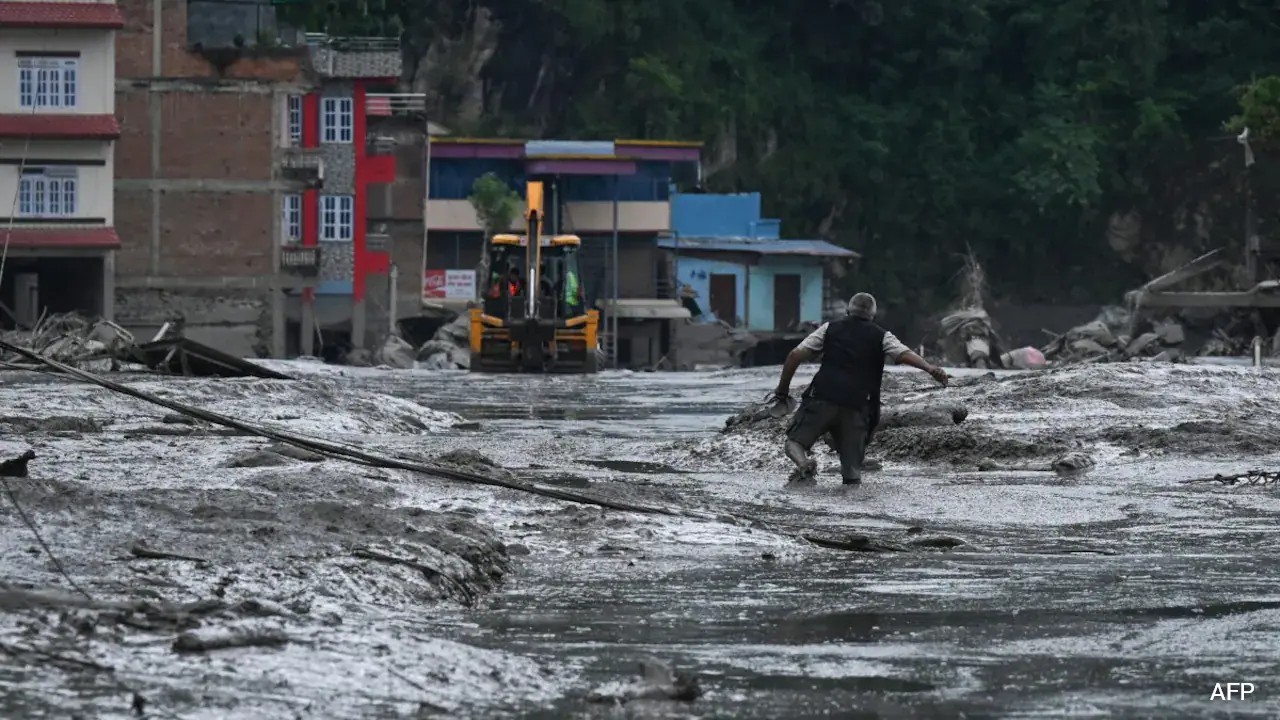
The ice-rock avalanche struck the Lhende Khola (also called Donglin Tsangpo) in Tibet, about 20 kilometres northeast of the Rasuwagadhi-Gyirong border crossing. Debris briefly dammed the river. When that natural barrier failed, a torrent of water, ice, rock, mud and sediment roared downstream. Surveillance footage from Gyirong Port, which circulated worldwide, shows the surge tearing through the customs and immigration complex. One analysis found the debris flow covered about 20 kilometres in roughly seven minutes - on the order of 180 km/h - aided by a drop of nearly 3,000 metres in elevation.
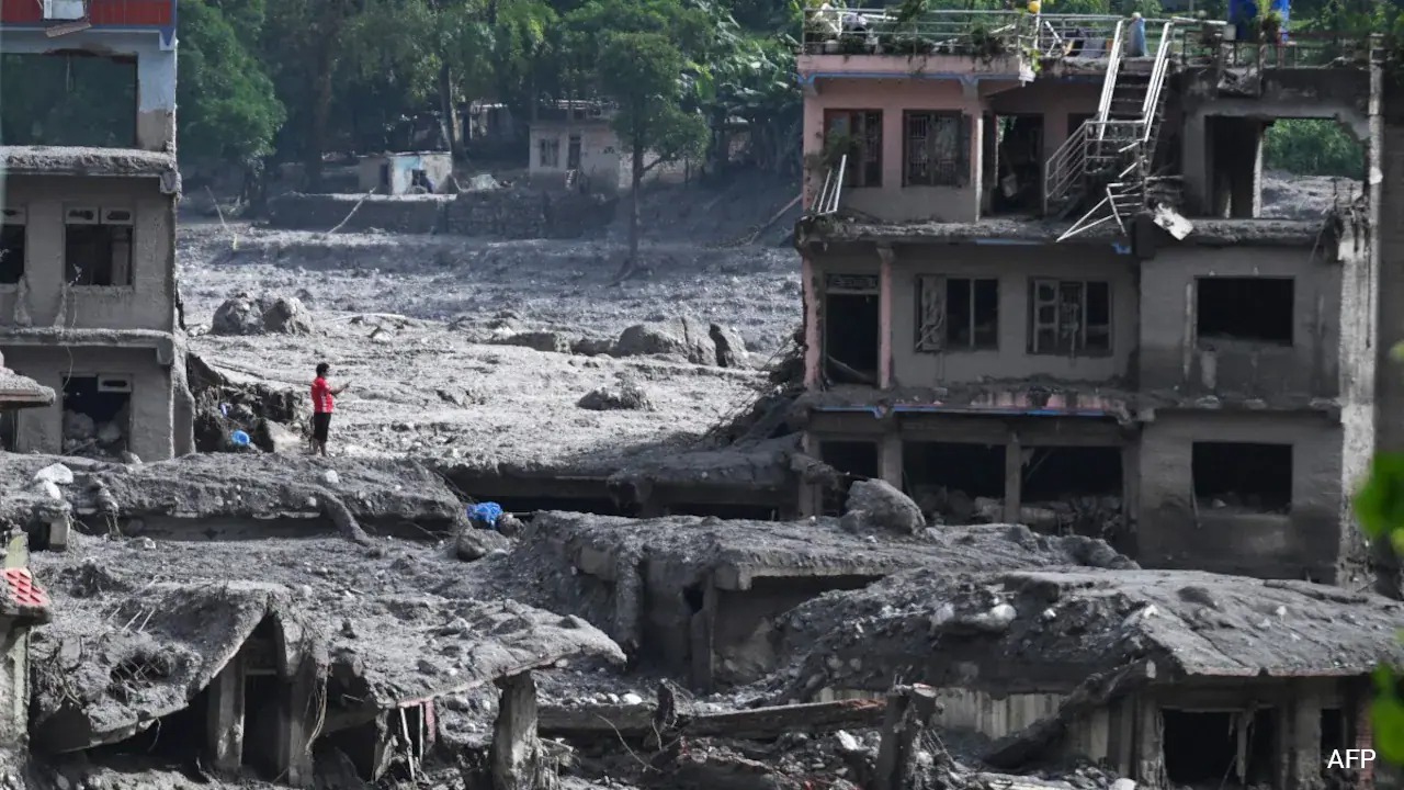
The flood then crossed into Nepal, destroyed the friendship bridge and Rasuwagadhi facilities, and raced down the Bhotekoshi into the Trishuli River system. Over the next hours it scoured settlements across Rasuwa, Nuwakot, Dhading, Gorkha, Tanahun, Nawalparasi and Chitwan - about 72 kilometres of river corridor. Water levels on the Trishuli rose by as much as nine metres in half an hour in some reaches. Bridges, roads, hydropower plants (including Rasuwagadhi, Chilime, Trishuli 3A and Devighat) and a 220 kV substation were wrecked. Early damage estimates in Nepal exceeded 200 billion Nepalese rupees. Bodies were later found more than 240 kilometres downstream in India.
Were there indications? Was there an alert?
Nepal’s flood-warning architecture is built around river gauges that detect rising water over hours - the pattern of monsoon and perennial floods. Those gauges were of little use here. At 8:40 a.m. Nepal time, the Syabrubesi station still recorded the Bhotekoshi at 1.62 metres, well below the 6-metre warning and 9-metre danger levels. By about 8:50 a.m. the station had stopped transmitting. Upstream instruments were swept away before they could trigger automated alerts.
The Department of Hydrology and Meteorology in Kathmandu did not receive official word until about 8:56 a.m., roughly 16 minutes after the surge crossed the border at Rasuwagadhi when the Rasuwa District Administration Office passed information through the NDRRMA. SMS alerts (more than 600,000 messages) went out shortly before or just after 9 a.m. to communities further down the Trishuli basin. Those messages helped some downstream towns; they arrived too late for Syabrubesi and other upper-valley settlements, which the flood reached within about 10 minutes of crossing the border. Some schools that received earlier informal warnings did evacuate children in time.
There ‘were’ earlier, general warnings. Twelve days before the collapse, China’s World Meteorological Centre emailed Nepali officials about enhanced rainfall and possible “secondary and cascading hazards,” including landslides and flash floods. China had also begun sharing Tibet rainfall forecasts with Nepal by WeChat and email about a month earlier. In May, Nepali hydrologists had asked Chinese counterparts for faster data on glacier movement and early slope instability - not only rain forecasts. Those requests had not produced a real-time, automated glacier-collapse alert by August 26. Nepal has a denser data-sharing arrangement with India than with China.
The China warning claim
Reports and social-media posts have alleged that Chinese authorities shared a warning only minutes before the water hit Nepal - sometimes stated as five minutes, sometimes as 45 minutes based on time-zone arithmetic and estimated travel time from Gyirong. Official timelines do not support a verified, last-minute Chinese alert that reached Kathmandu in time to evacuate the upper valley.
What is documented: the surge blasted through Gyirong Port around 8:32–8:44 a.m. Nepal time. About 26 minutes after that footage, a senior Nepali flood official received a call from the NDRRMA chief about flooding on the Trishuli. Nepal’s first formal notice came from its own district office and from locals who saw water coming from Kerung/Gyirong - not from a pre-arranged Chinese emergency channel. A border monitoring station on the Nepal side had already gone silent.
China rejected allegations that it failed to warn Nepal, calling some claims “fake news” and citing the extreme altitude, steep terrain and speed of the event. The Chinese embassy said Beijing had given Nepal access to its MAZU meteorological warning platform and that the two sides had discussed disaster information-sharing. After the disaster, China ‘did’ pass information on a newly formed barrier lake and later on increased upstream flow data Nepal used for fresh alerts on August 30 when the Bhotekoshi rose again. Those post-event exchanges are not the same as a minutes-ahead warning on August 26.
Minister for Science, Technology and Innovation Mahabir Pun said publicly that Nepal received no usable warning because the flood reached the country within about half an hour of the upstream failure. Hydrologists have said that if they had been told while the mass was still building in Tibet, casualties in the first kilometres of the Nepali valley could have been lower. Whether Chinese instruments actually registered the collapse in time to issue such a call remains disputed; China has emphasised technical limits rather than confirming a delayed message.