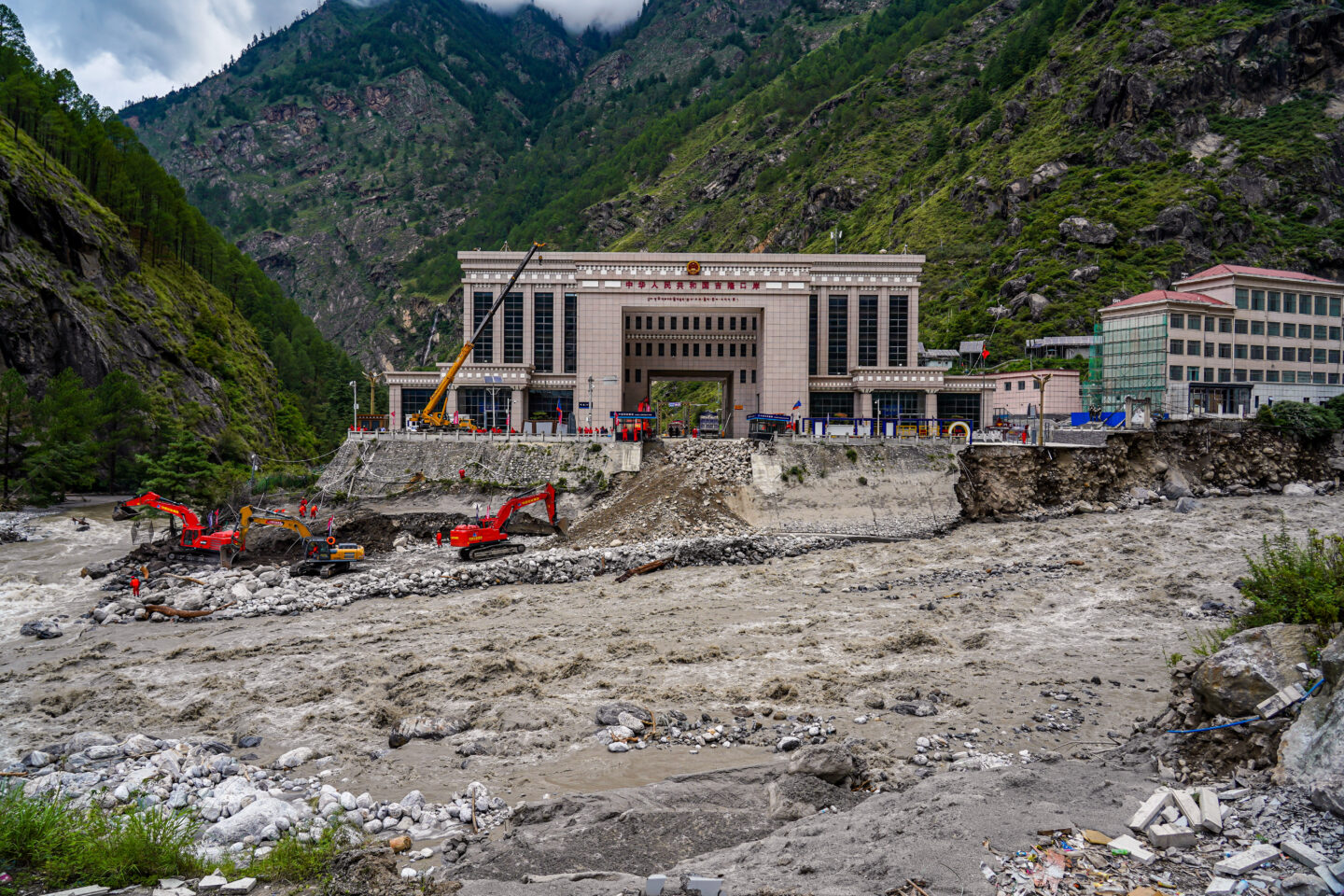
As rescue teams continue searching remote valleys in Nepal’s Rasuwa district, scientists and officials are piecing together the chain of events that sent a wall of water and debris roaring down the Bhote Koshi River early Wednesday. Preliminary findings point not to ordinary monsoon rainfall, but to a cascade of high-altitude mountain processes that began with a modest earthquake and may have involved an ice-rock avalanche, temporary river blockage, and the release of stored meltwater.
The Timeline of a Cascading Disaster
According to Nepal’s Foreign Affairs Minister Shishir Khanal, a magnitude 4.4 earthquake struck Tibetan territory at approximately 8:37 a.m. local time, roughly 47 kilometres north of Gosainkunda. Within minutes, a sudden surge entered the Bhote Koshi system from the upper catchment, reaching the Nepali towns of Timure and Syapru Besi around 9 a.m. The German Research Centre for Geosciences recorded the quake about seven minutes before security-camera footage on the Chinese side captured people fleeing an approaching wall of mud, rock and water.
Local rainfall in Rasuwa itself was minimal. Nepal’s Flood Forecasting Division has stated that heavy precipitation within the district was unlikely to explain the scale of the flood. Satellite data, however, showed significant rainfall on the Tibetan side of the border, adding moisture to an already unstable high-altitude environment.
Climate and disaster specialists at the International Centre for Integrated Mountain Development (ICIMOD) in Kathmandu have identified an ice-rock avalanche from a glacier as the most probable immediate trigger. The Lhende Khola, a tributary of the Bhote Koshi that flows through both Nepal and Tibet, experienced the most intense flooding.
Researchers describe a sequence in which a mass of ice and rock slid into the Lhende Khola, temporarily damming the river. Water then ponded upstream until the natural barrier failed, releasing a sudden, high-volume surge downstream. Rijan Bhakta Kayastha, a professor and climate researcher at Kathmandu University, noted that early assessments indicate an ice avalanche originating on the Nepali side may have blocked the river, allowing water to accumulate before the dam burst. Saswata Sanyal, a disaster risk reduction specialist at ICIMOD, observed that the Lhende Khola has now flooded twice in fourteen months, with this event linked to an ice-rock avalanche that blocked the channel and produced an abrupt release.
Alternative and Complementary Indicators
Glacial Lake Outburst Flood (GLOF) contribution: The same river system suffered a deadly flood in 2025 after a supraglacial lake in Tibet drained. Experts note that unstable glacial lakes held by ice or debris dams remain a persistent risk in the region. Some assessments suggest the avalanche may have interacted with or triggered the partial drainage of such a lake.
Permafrost and debris-flow dynamics: Geological evaluations point to possible permafrost collapse in the upper catchment of the Lhende River on the Tibetan side, generating a large debris flow that fed directly into the river system.
Seismic triggering of unstable slopes: Even a moderate earthquake can destabilise steep, ice-rich slopes in the Himalaya. The close temporal proximity between the recorded quake and the onset of flooding strengthens the case for a seismic trigger of the avalanche.
Cross-border moisture input: While Nepali stations recorded little rain, rainfall on the Tibetan plateau likely increased the volume of water available to be released once any temporary dam failed.
Authorities on both sides of the border are examining satellite imagery and coordinating data to refine the sequence. A residual blockage remains upstream on the Lhende Khola, prompting warnings of a possible secondary flood.