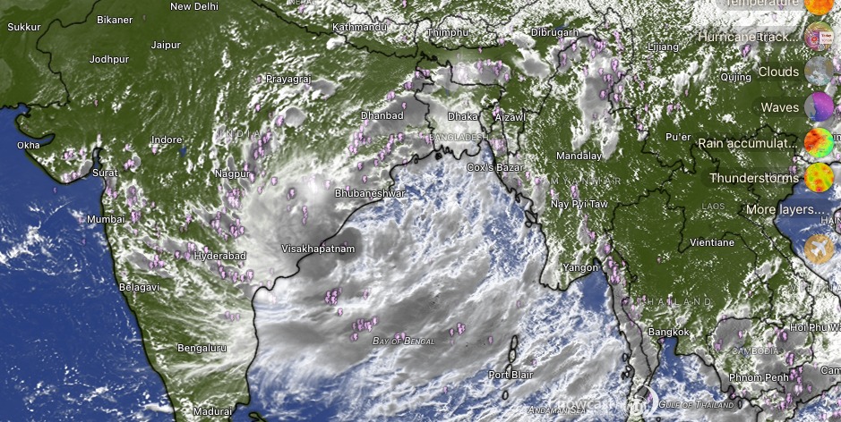
A weather system over the Bay of Bengal intensified into a depression on Monday and is expected to strengthen further as it moves west-northwestwards towards the north Andhra Pradesh–south Odisha coast. The system is currently not a cyclone, and the India Meteorological Department (IMD) has not confirmed any transition into Cyclone ‘Arnab’.
The depression is likely to intensify into a deep depression and cross the coast between Visakhapatnam and Gopalpur during the night of September 23 and the early hours of September 24, according to the IMD.
Bengal to Feel the Impact
Although the system is not expected to make landfall over West Bengal, its circulation is likely to influence the state's weather. The IMD has forecast rain and thunderstorms across several districts, with gusty winds also expected in parts of the state.
The Regional Meteorological Centre in Kolkata has issued an orange alert for Birbhum and Murshidabad, warning of intense rainfall, thunderstorms, lightning and gusty winds of around 30–40 kmph. A yellow alert has been issued for Kolkata, Bankura, Hooghly, Malda, Nadia, North 24 Parganas, South 24 Parganas and several other districts.
South Bengal is expected to see increased rainfall activity over the coming days, with coastal districts particularly likely to experience the effects of the system. The weather office has also warned fishermen against venturing into the sea during the period of adverse weather.
Is Cyclone ‘Arnab’ Forming?
The developing system has triggered speculation about Cyclone ‘Arnab’, the name assigned to the next cyclone in the region by Bangladesh.
However, as of Tuesday, the IMD has described the system as a depression expected to intensify into a deep depression. There is no official confirmation yet that it will become a cyclonic storm.
For Bengal, the immediate concern remains the possibility of several days of rain, thunderstorms and gusty winds, rather than a direct cyclone landfall.
With the system expected to move towards the Odisha-Andhra coast, weather conditions in West Bengal will continue to be closely monitored over the next few days.